3D Data Acquisition
Waves Group can provide cutting edge survey and data acquisition technology together with specialist marine engineering expertise to provide clients with a unique capability to visualise assets and damage following incidents and interrogate the data to increase certainty and manage risks.

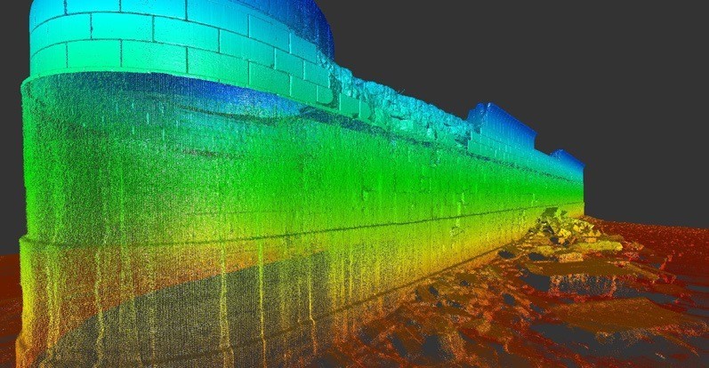
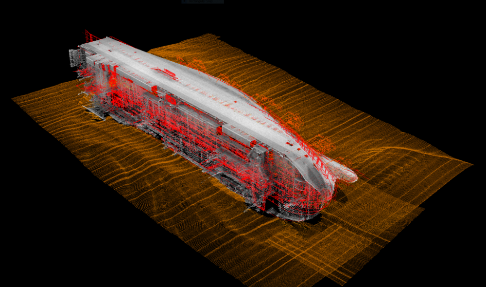
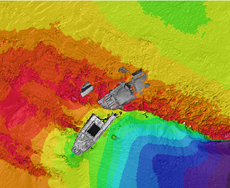
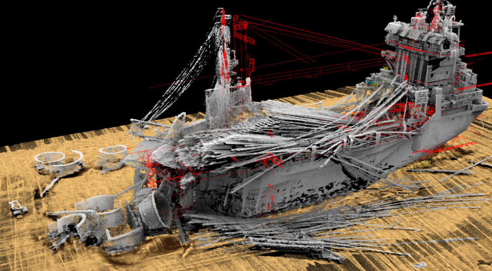
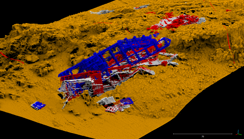
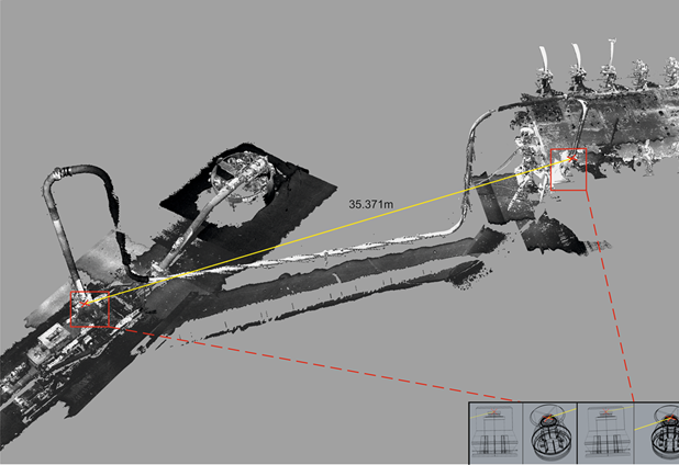
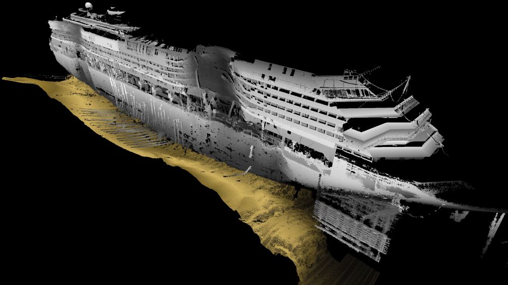
The expertise developed by Advanced Underwater Surveys Ltd (ADUS), who have pioneered the use of high-resolution 3-D and point-cloud imagery in salvage and wreck removal projects since 2006, are now part of Waves Group. This experience includes notable projects such as Costa Concordia, Deepwater Horizon, Sewol and MSC Rena amongst many others.
Waves Group can now offer enhanced services to acquire, interrogate and visualise complex and changing data sets, with presentation in simple formats designed to allow easy engagement by all parties and stakeholders ‘anytime-anywhere’. This can include still images (including overlays with drawings), video footage and 3-D walk or fly-through capabilities including augmented and virtual reality presentations to enhance understanding and interrogation of the data. We combine the data obtained with our extensive marine and offshore engineering expertise to provide our clients with practical solutions for risk management on their projects.
Below is a video showing examples of high resolution 3D survey visualisations.
By visualising the condition of the vessel or asset, project teams can better understand the impacts and risks involved, allowing rapid evaluation of options, remedial measures and the better management of risks. It greatly enhances the engagement with authorities to help reach agreement.
Typical applications include:
- 3-D imagery for salvage and wreck removal projects
- Damage inspections following incidents
- Fusion of multiple forms of data and evidence in a single environment for incident investigations
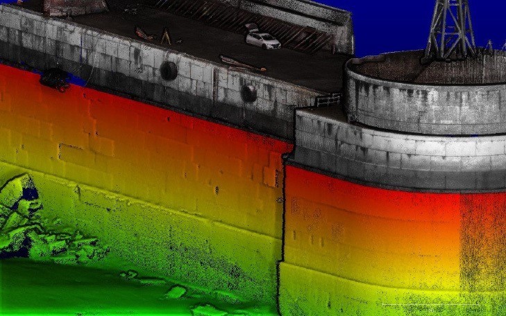
- Survey and inspection of port facilities
- Survey and inspection of sub-sea assets including power cables, moorings, risers, subsea architecture and fixed platforms
Our services include:
- 3D ‘point-cloud’ data acquisition and modelling
- 3D imagery and visualisation including augmented and virtual reality display
- Drone and Autonomous Underwater Vehicle or ROV footage (still and video)
- Subsea Laser scanning, Multi-Beam Echo Sounder (MBES)
- Photogrammetry techniques
- Base-line condition reporting and monitoring of changes over time
- Asset integrity monitoring and structural assessments
- Bathymetry surveys and charting
- Engineering and operational assessments using acquired data
- Risk assessments (including Quantitative Risk Analysis) using the acquired data to help define work scope and predict schedule/costs
See images of other 3D survey illustrations below.